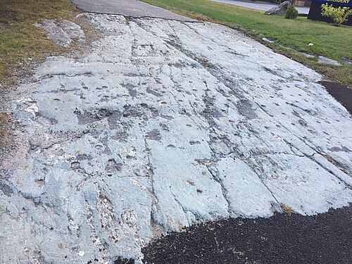
In Ellsworth, Maine, right along Route 1, sits a dark ledge of scratched rock. Most drivers speed right past it. In 1864, Louis Agassiz stopped his carriage here to inspect the deep, parallel grooves gouged into the Ellsworth Schist. At the time, mainstream scientists blamed Noah's Flood for these weird scars, calling the phenomenon diluvial drift. Agassiz disagreed. He envisioned a massive, crawling sheet of ice grinding over the continent. Actually, he proved his theory right at this spot.
Agassiz used this outcrop to validate his radical Ice Age theory in North America. The scratches run from the northwest to the southeast, a precise heading that water couldn't easily replicate. That specific direction mattered. It matched the flow of a massive, grinding glacier, not the chaotic slosh of a receding global deluge. He published his observations in 1864, pointing directly to Hancock County as his proof. Skeptics folded. Geologists eventually abandoned their biblical flood models because of this Ellsworth ledge. So, a simple roadside rock ended up rewriting natural history.