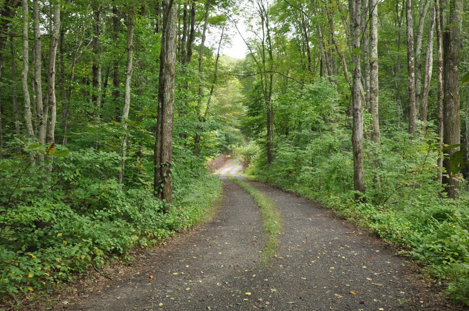
History isn't always in museums. Sometimes it is just a muddy, narrow track through the woods of Andover, Connecticut, where five thousand French soldiers dragged heavy brass cannons in the summer of 1781. This quarter-mile stretch of Bailey Road looks almost exactly as it did when General Rochambeau's men marched through. Just dirt, rocks, and ancient stone walls. The French forces were rushing south to meet George Washington's army, aiming to trap British General Cornwallis at Yorktown. Rochambeau's engineers drew incredibly detailed maps of the route, noting every steep hill, swamp, and tavern along the way. Those yellowed maps allowed modern preservationists to identify this bypassed segment of Bailey Road before modern developers could pave it over.
The march was brutal. French infantrymen clad in thick white wool uniforms trudged through suffocating July heat, choked by dust raised by hundreds of supply wagons. They cursed the rocky Connecticut soil, which broke wagon axles and exhausted the oxen. But local farmers welcomed them. The French army paid for beef, cider, and firewood in cold, hard silver coins, a massive relief for locals holding worthless Continental paper money. So, the arrival of the foreign troops turned into a brief, profitable festival at every campsite along the way, including the nearby stop in Bolton.
Today, the site is a quiet ghost of that massive logistical feat. While most of the 1781 route disappeared under modern asphalt like Route 6, this dead-end section of Bailey Road remained frozen. It is narrow, and thick oak trees crowd the edges. You can still see the original stone boundaries that hemmed in the marching columns. Walking it feels like stepping into the past.
What Makes March Route of Rochambeau's Army: Bailey Road Special: